Area: At around the 1800 Century, the area of undivided Sundarban was 16,700 sq.mtrs. At present, it is reduced to 10,813 sq. mtrs.
After fixation of the boundaries of India and Bangladesh in the year 1947, out of the total area, 62 percent went to Bangladesh (Chandpai, Sharankhola, Khulna and Shatkhira) and the remaining 38 percent is added to India (Namkhana and Bashirhat Range).
At that time, Shridhar Chakraborty (1896) was appointed as the first Forest Officer of India.
At present the forest coverage of Indian Sundarban is 4,726 sq.kms. Out of it, 55% is Sanctuary.
Sanctuary: For conservation of the forest and the forest animals, four sanctuaries have been formed.
 |
| Netidhopani Tourist Spot |
They are: Sundarban National Park, Sajnekhali Sanctuary, Lothiyan Dweep and Holiday Deep Sanctuary.
 |
| Dobanki Tourist Spot |
Administrative Work: For administration of the forest, it has been divided into Tiger Project and South 24 Parganas Forest Department.
 |
| Deer are Waiting |
HumanPopulation: Human settlements used to be and scattered in Sundarban since prior to the Mughal era. This forest region was devasted due to natural calamities and frequent attacks by the ‘Mag’and Portugueses.
Human settlements started building up afresh after the Britishers arrived. There are many evidences of the same from the remains of devastations recovered from various parts of Bakhargunj, Khulna and Southern parts of the two 24 Parganas.
Around the year 200 B.C., there used to happen arrivals of many human groups. The religion of Buddhism had basic propagation here since the 600 Century BC. Since the Sen dynastic period only, due to huge pressures from one tribe of this community, various communities were originated.
 |
| Durga Puja |
The area is the habitat of people of communities like Paundra, Kshatriya, Hindu, Muslim, Christian, Munda, Santal, Oraon, Das, Devdasi. In the 1800 Century, Mundas were brought for labour work and occupying the forest from Ranchi, Singbhum, Manbhum, Palamon, Chhapra, Hazaribaug to Sundarban and retained as slaves. Most of the Mag water-plunderers were
 |
Living God
Buddhists. Before departing from Sundarban, many Mag-families concealed themselves in Sagardweep, Canning, Magrahat, Joynagar and surrounding areas. They are still left there. Paundra community people were mostly Buddhists. Buddha Purnima or (Baisthakhi Purnima) is celebrated even today with respect and holiness on 4th May (21st Baikshakh).
|
Total islands: 10237 lacs 57 thousand 356 people reside in
54 islands (19 blocks). [As per the 2011 census of the Central Government].
At present more than 50 lacs people reside at Sagardwep (largest
population). Nine Gram Panchayat has a population of 1,33,365 people.
Mangrove forest and forest animals are located in 48 islands. Patharprotima block has the maximum islands. There are 13 islands there.
 |
| Hamilton Bungle at Gosaba |
There are 9 islands in Gosaba,
5 in Namkhana,
6 in Sandeshkhali and
5 in Haroya block.
Birth rate: 933 girl children are born per each 1000 male members (As per the 2009 census).
 |
| Tribal Population |
Castes: Scheduled castes – 65%,
Tribes: Scheduled Tribes – 38%
(Paundra, Kshatriya, Devdasi, Das, Munda, Oraon).
 |
| Women Farmar |
Occupation: Agriculture, fish-farming, plucking honey from the forest, hunting of fishes and crabs from the rivers (are exported outside the
country).
 |
| Men Farmar |
Division of the district: 24 Parganas have so far been divided 3 times. In 1814, 1834 and 1986 (1st March).
 |
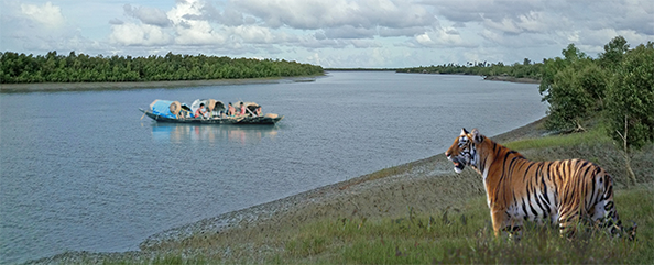
| Transport of Sundarban |
Blocks: Sundarban is made up of 19 blocks of North and South – two Twenty Four Parganas. Most of these areas are forests (There are 6 blocks in
 |
| Rain in Sundarban |
North 24 Parganas) – They are – Hingalgung, Sandeshkhali – 1 and 2, Hadoya, Minakhan and Hasnabad. All are populated areas. There is no forest here (There are 13 blocks in
 |
| Taki Tourist Spot (Basirhat) |
South 24 Parganas) –
They are – Canning – 1 & 2,
Basanti,
Gosaba,
Joynagar 1 & 2,
Kultali,
Mathurapur – 1 & 2,
Kakdweep,
Namkhana,
Patharpratima and
Sagardeep.